Title: NERO Fire Brief: Sakarya, Gevye Wildfire – Türkiye, July 2025
Date: 23 July 2025
Authors: Assoc. Prof. Dr. Kadir Alperen Coskuner and Dr. Georgios Papavasileiou ; WG4 – European Network on Extreme Fire Behavior (NERO)
Summary:
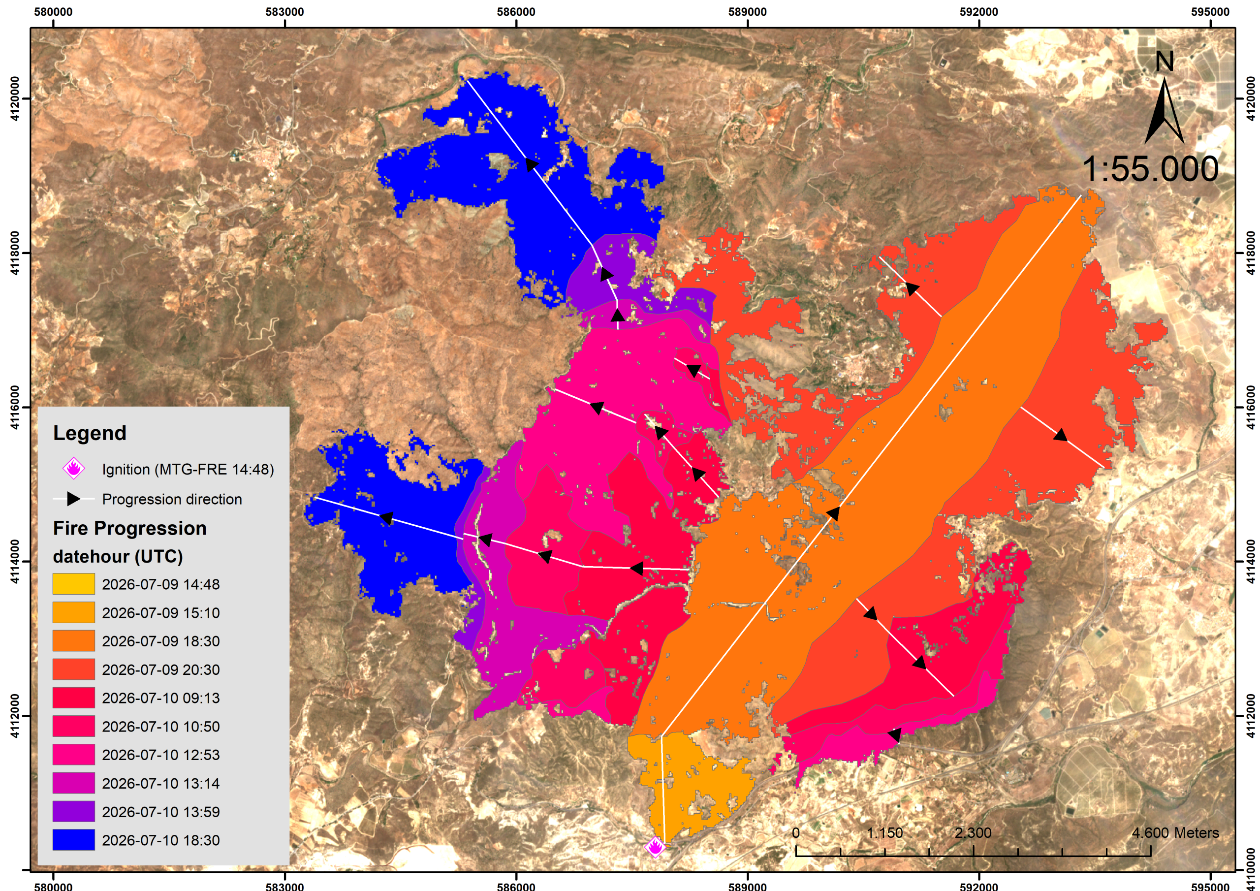
On 20 July 2025, a wildfire ignited in pine forest near Hacılar village in Sakarya’s Gevye district, Türkiye. Though wind speeds were moderate (<15 km/h), the fire exhibited severe and complex behavior, advancing ~9.2 km in under five hours.
Fire Behavior Highlights:
- Rapid rate of spread (~1.84 km/h)
- Spotting and active crown fire
- Fire-generated vortex (FGV) observed
- Fire whirls developed under turbulent, convective conditions
Preliminary satellite analysis indicates approximately 6,380 hectares were burned by 22 July, including forest, shrubland, agricultural, and residential areas.
The fire reached Bilecik Province, forcing the evacuation of at least four villages and temporary road closures. As of 23 July, the fire was nearly under control, but hotspots remained active.
Key Details:
- Date: 20 July 2025
- Location: Gevye-Hacılar, Sakarya, Türkiye
- Coordinates: 40.46279° N, 30.17417° E
- Size: ~6,380 ha (as of 22 July)
- Elevation: 100–750 m asl
- Fuels: Pine forest, maquis shrubland, grass
- Fire Type: Surface and crown fire
- Extreme Indicators: Fire-generated vortex, fire whirls, rapid spread
News Coverage:
📄 Read the full Fire Brief PDF:
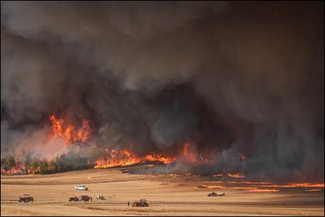
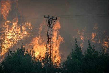
Figure 1. Images from ongoing fire (a, b) (21.07.2025). Source: AA
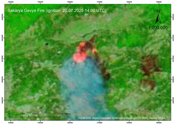
Figure 2. The MODIS (Aqua) Corrected Reflectance image (Bands 7-2-1) for this fire (21.07.2025) Source: NASA
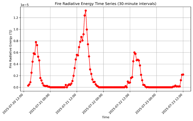
Figure 3. MSG SEVIRI Fire Radiative Energy diagram of the Gevye fire (Time-UTC), Source: EUMETSAT
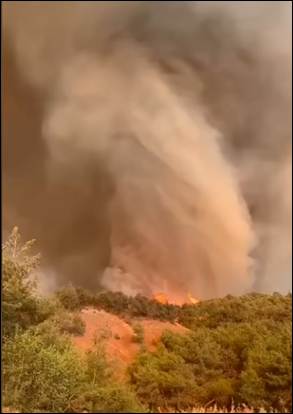
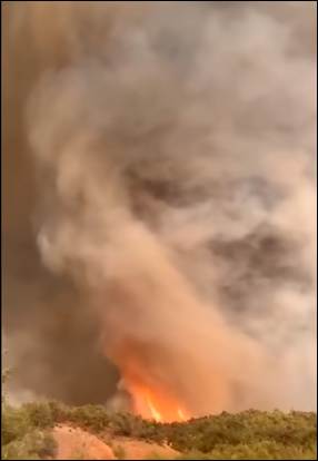
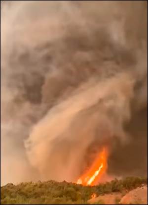
Figure 4. A low-level Fire-Generated Vortex (FGV) was observed during this wildfire, Source: GDF
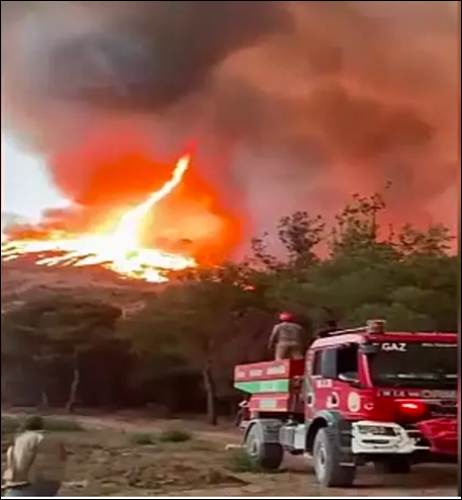
Figure 5. Fire whirls occurred during this wildfire, Source: DHA
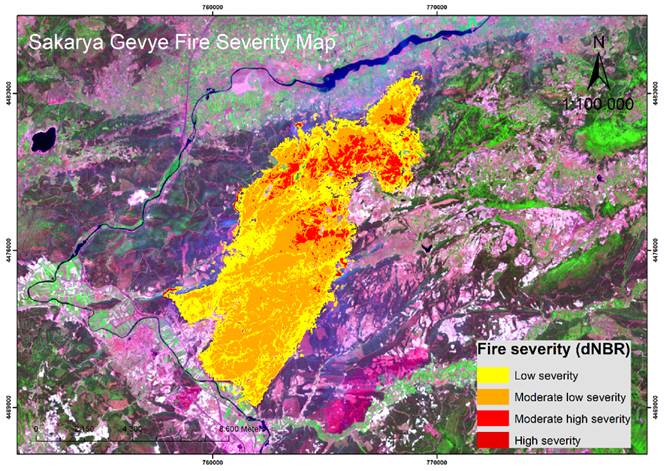
Figure 6. The results of initial differenced (or delta) Normalized Burn Ratio (dNBR) analysis of fires using Sentinel-2 images, captured on 22 July 2025 at 08:45 UTC. Source: ESA – Sentinel-2.
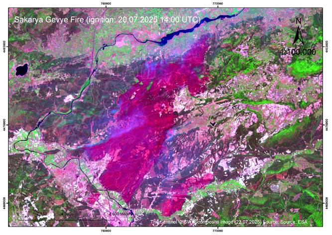
Figure 7. Sentinel-2 Shortwave Infrared (SWIR) composite images of the ongoing fire, captured on 22 July 2025 at 08:45 UTC. This satellite composite image reveal thermal characteristics of the fire, offering critical insights into its early spread and intensity. Active parts are visible. Source: ESA – Sentinel-2.